


Hastings And Bexhill Street Plan
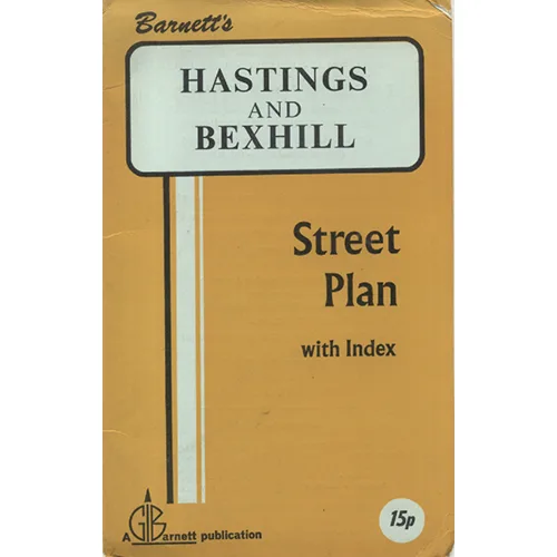
Publisher: Garnett
ISBN: none
In a world dominated by Google Maps and GPS devices that have a tendency to lead you into trees, the Hastings and Bexhill Map by Garnett is a delightful throwback to a simpler time—when asking for directions involved nothing more than a friendly local, a vague hand gesture, and a perhaps slightly exaggerated recounting of the number of lefts to take. This map is not just a navigational tool; it’s a nostalgic journey into a world where the only traffic jam was a herd of sheep crossing the road and where every wrong turn led to an unexpected tea room serving questionable scones.
Published circa 1965, this map is a masterclass in cartography from an era when the notion of a digital footprint was as foreign as the idea of pineapple on pizza. The author, Garnett, has etched his name into the annals of history with this piece, which is all but a time capsule of Hastings and Bexhill—two seaside towns that may or may not have been the epicentres of the British holidaying experience. One could almost feel the salty breeze and hear the distant wails of seagulls as they trace the carefully drawn lines, each curve and squiggle brimming with promise and the faint whiff of fish and chips.
One cannot help but marvel at the sheer audacity of a world where street names were often little more than a nod to local history and the occasional pun. You might find yourself wondering just how many other maps were produced during this golden age—maps that probably held the secrets to fishing spots, ice cream trailers, and the whereabouts of the best seaside amusements. Garnett’s cartographic talent shines through in the meticulous detail, showcasing every nook and cranny of Hastings and Bexhill, each marked with a flourish that could only have been achieved with a steady hand and a cup of Earl Grey nearby.
Moreover, this map serves as an excellent conversation starter in any social gathering of vintage enthusiasts. Imagine the intrigue as you whip it out, only to hear gasps of wonder at the idea of navigating without the aid of technology. You may even inspire a resurgence of map-reading aficionados who will flock to your side, eager to share stories of their own navigational misadventures across the UK.
As if that weren’t enough, the Hastings and Bexhill Map comes with its very own set of quirks, which only a book as venerable as this could possess. The paper is deliciously brittle, with a few battle scars from decades of handling, not to mention mysterious stains that could easily be the remnants of a long-forgotten seaside picnic. Each crease tells a story, and who wouldn’t want to own a piece of cartographic history that also doubles as an art piece, complete with unique patina?
Condition: This map has been lovingly used, showing signs of age that only add to its character. The edges are frayed, and various folds reveal the passage of time and a few unintentional coffee rings—an alluring collection of imperfections that whisper sweet nothings of nostalgia. It’s clear this map has seen more than its fair share of seaside jaunts; if only it could talk, it would regale you with tales of sunburned tourists and the occasional lost dog. But fear not, dear reader, for those quirks make it all the more charming.
In conclusion, if you’re looking to adorn your wall with a piece of vintage cartography or are simply in need of a decorative item that sparks conversations, the Hastings and Bexhill Map by Garnett is a must-have. It’s perfect for anyone who appreciates the romanticism of a bygone age, when holidays were lived out in glorious technicolor, and there was no such thing as a wrong turn—just an opportunity for adventure. Available now at Crappy Old Books, where every book has a backstory, and every map is a journey waiting to unfold.
Keep browsing: See more Maps books Other books by Garnett
